
Arrow mapper
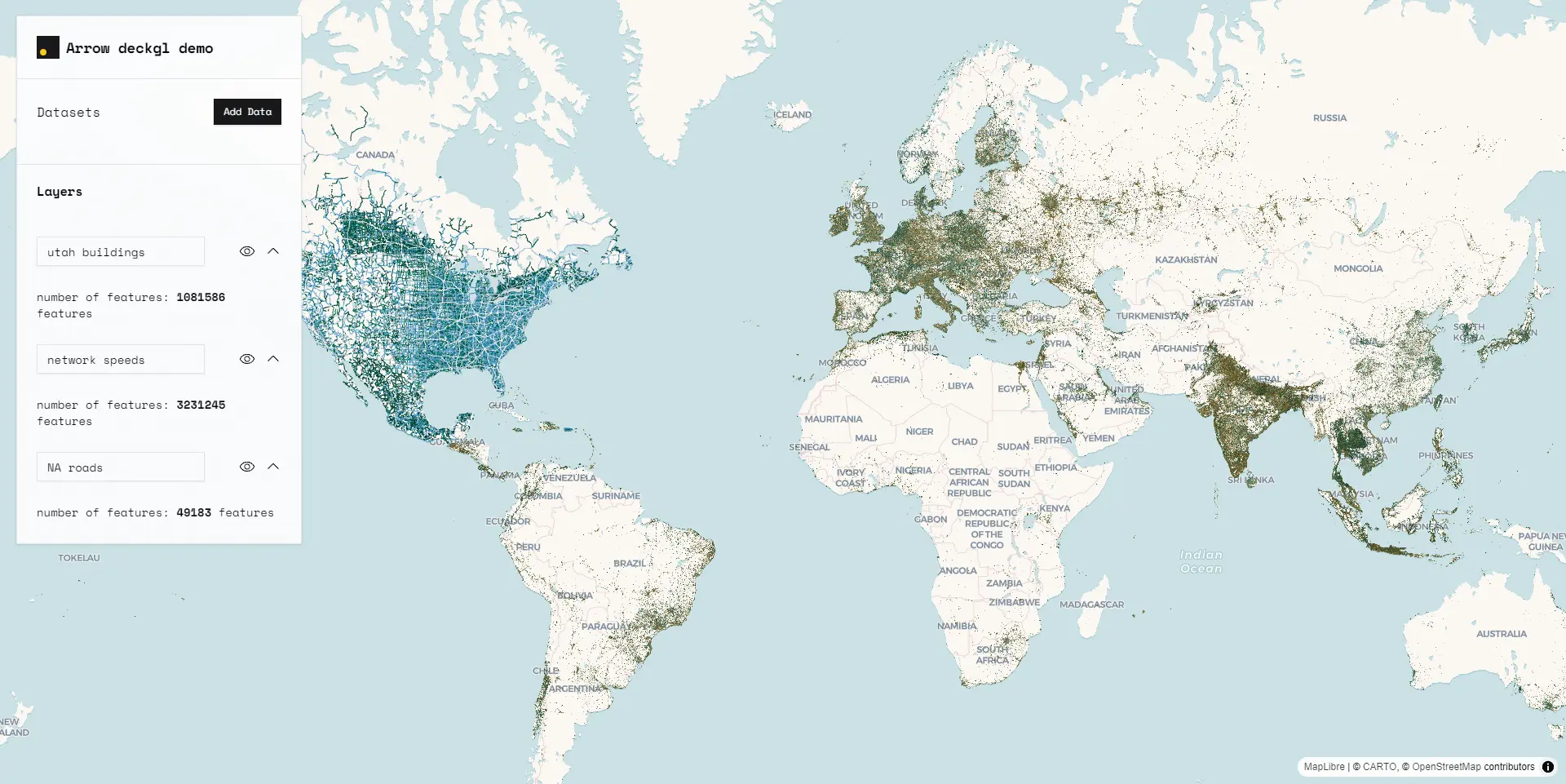
Arrow mapper
A quick dirt apache arrow file mapping demo with deckgl as a proof of concept for replacment of GeoJSON and forward to cloud native formats with cabability to be used in web mapping large datasets with millions of features.
Micronesia digital atlas
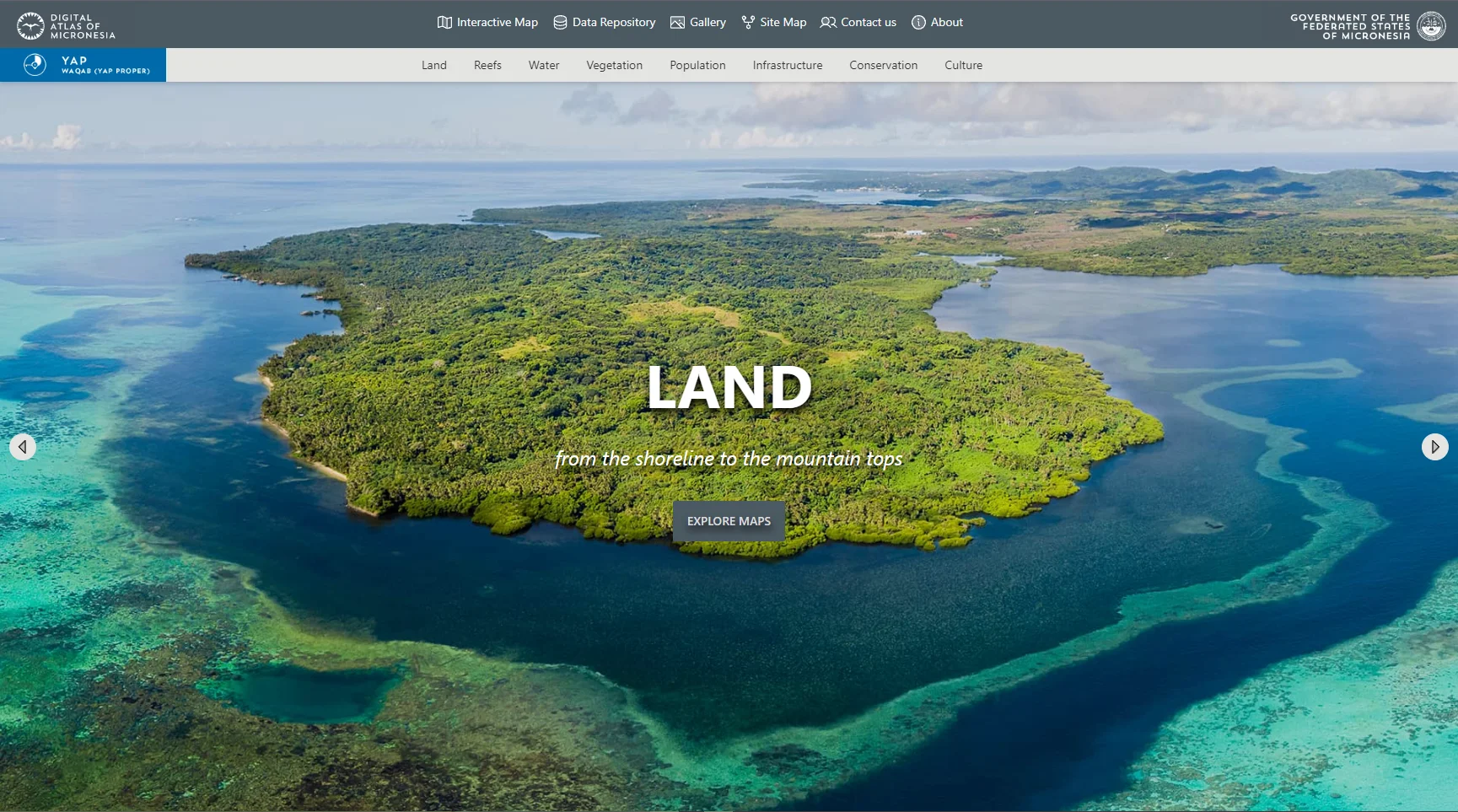
Micronesia digital atlas
A digital atlas for the federal state of micronesia for educational and scientific purposes with over 600 maps, datasets and images, static and interactive providing extensive information about Micronesia.
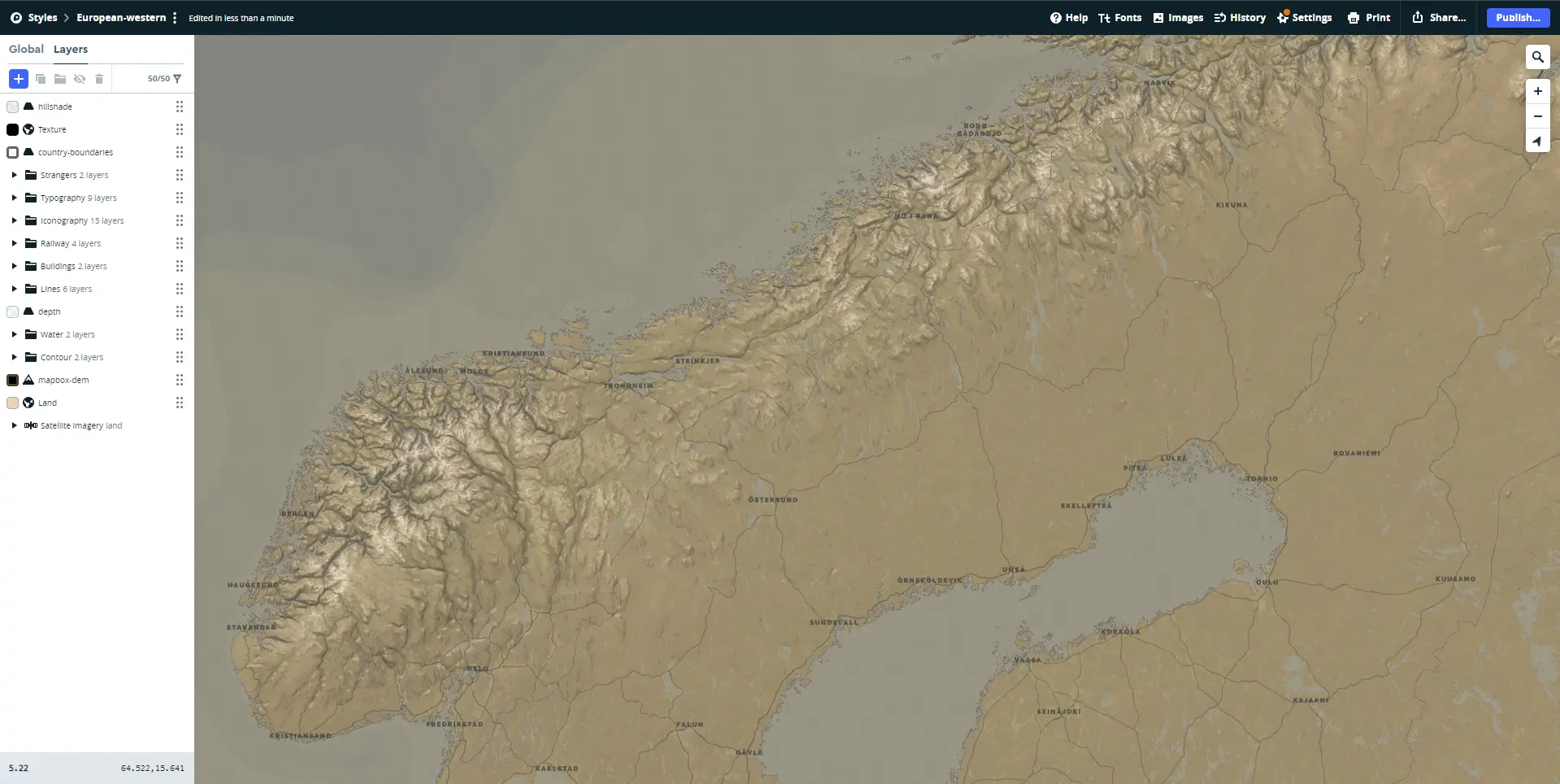
CLC office dashboard
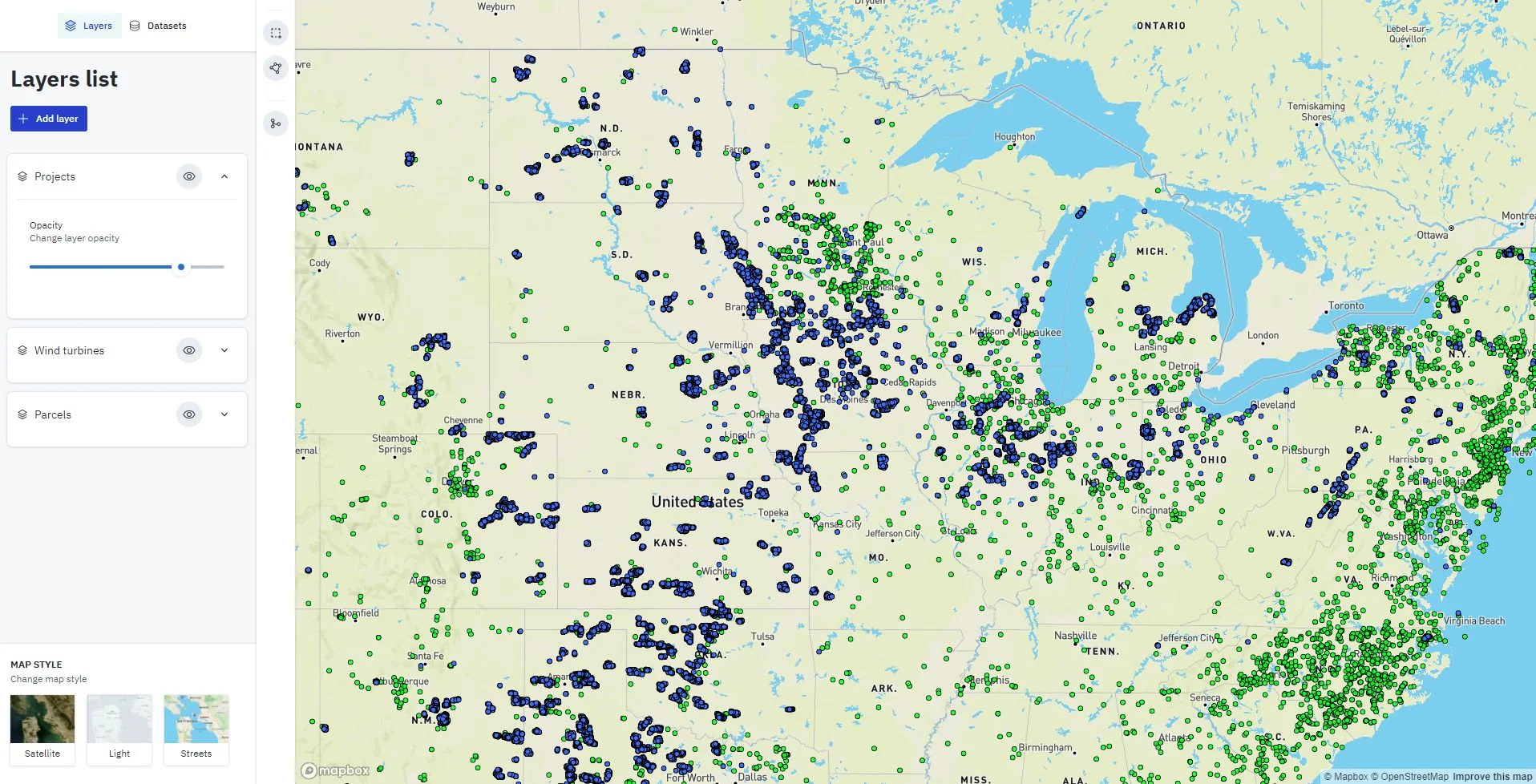
CLC office dashboard
GIS web platform for back office processing and management of renewable energy data and land parcels which contains energy facility established on accross the United state, loading very heavy dataset of 700k features at once with solid 60fps webGL performance
Sainai desert terrain
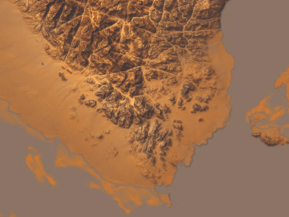
Sainai desert terrain
Cartographic experimentation for terrain modeling and shading relief to memic BF1 game famous map (Sainai desert) style and color scheme
Rdr2 mapbox style
Rdr2 mapbox style
Cartographic experimentation RDR2 game style map blending with satellite imagery and terrain shadows
SafeDrop
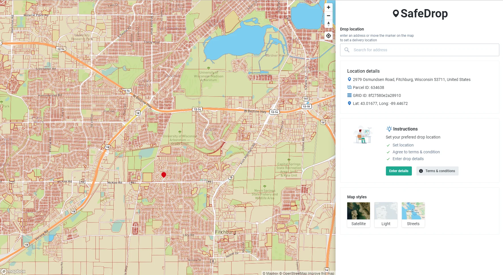
SafeDrop
Web application which utilizes maps and H3 indexing to make easy construction material delivery to site under predefined terms and conditions, reciving and processing orders
Ekhtar Ardak
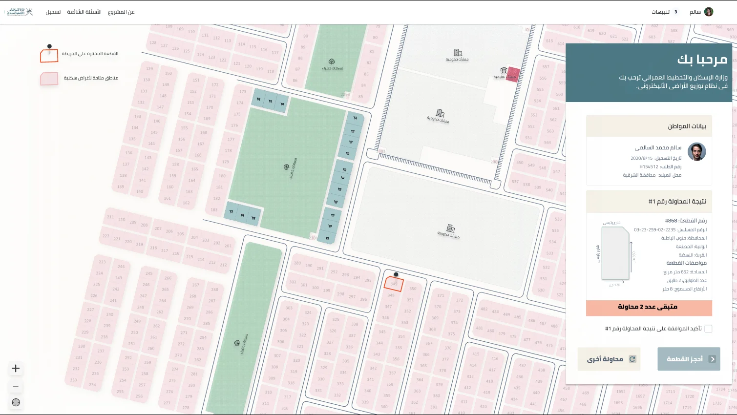
Ekhtar Ardak
Web application UI/UX for the Omani ministry of housing and urban planning for the process of random selection for purchasing and owning vacant land parcels for invesement or housing puroposes
Faces Behind Numbers
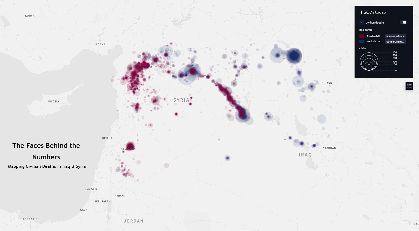
Faces Behind Numbers
A digital interactive map for civilian casualty in Iraq and Syria between 2014 to 2024 by both US lead coalition and Russian military air forces
Forgotten Places
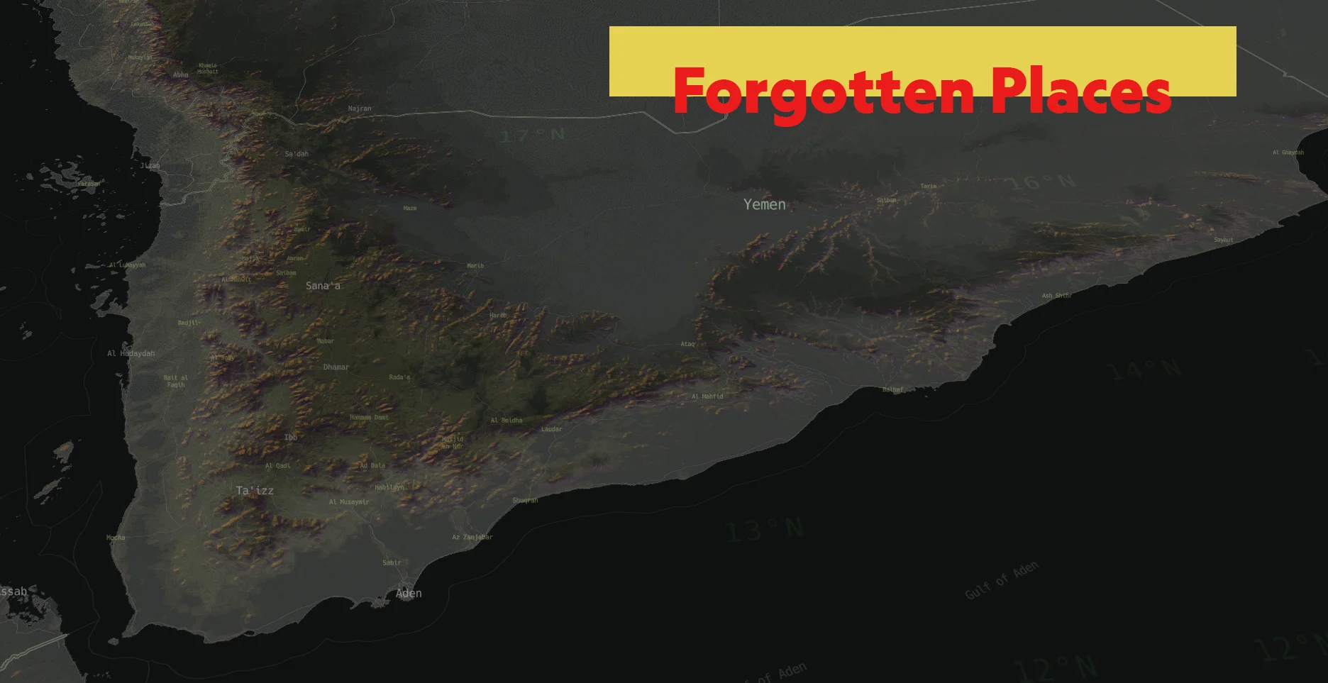
Forgotten Places
My observations on the camouflage Mapbox style suggest the addition of a mist layer. This would subtly emphasize the terrain in specific locations that are often overlooked or underappreciated due to various factors.
US gaslines network
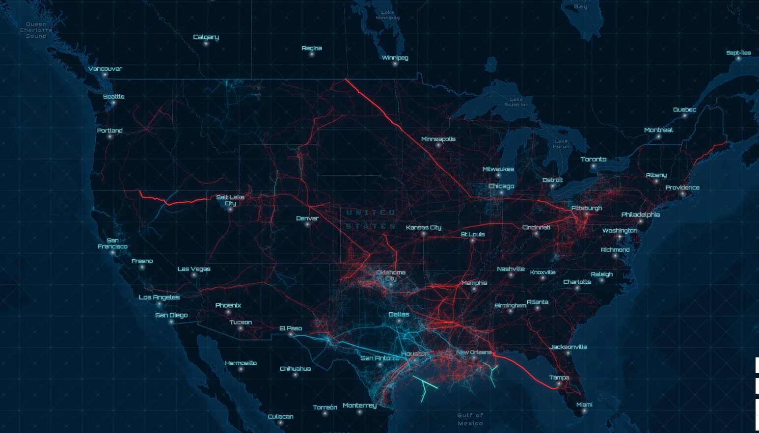
US gaslines network
Cartographic representation of gaslines pipeline network in the united states over different types of vector tiles based styles in ArcGIS online
30 days of precipitation

30 days of precipitation
Animated map using h3 index for parsing precipitation data over the united states in 30 days period
US Population
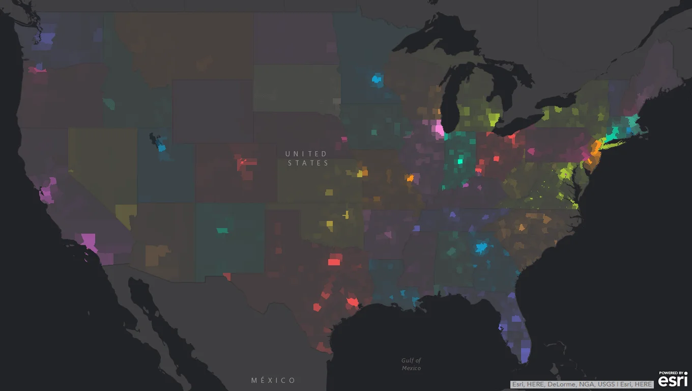
US Population
This digital map of US population density utilizes an opacity-based value system to visually represent the density variations. This technique creates an illumination effect, highlighting areas with greater population concentration.
Nile River, loses & gains
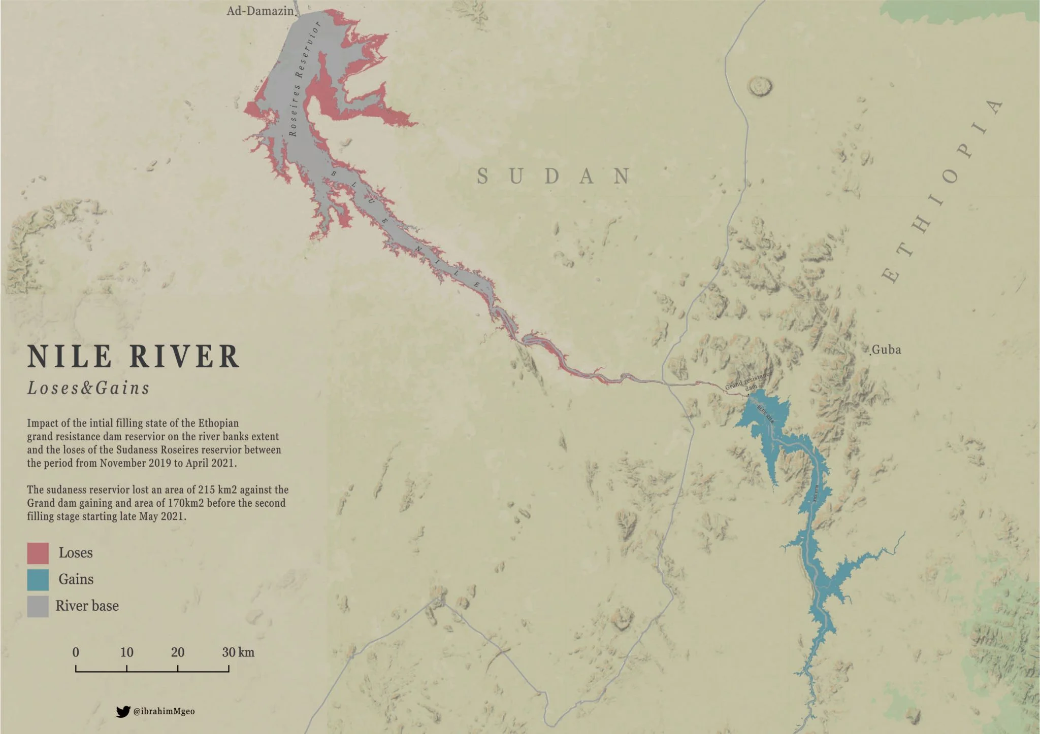
Nile River, loses & gains
Change detection spatial analysis conducted from Landsat satellite imagery to study the Impact of the initial fill of the Ethiopian grand resistance dam and the loses for the Roseries dam in Sudan after the initial refill of the grand dam reservoir from Nov 2019 to April 2021.
Amazonia
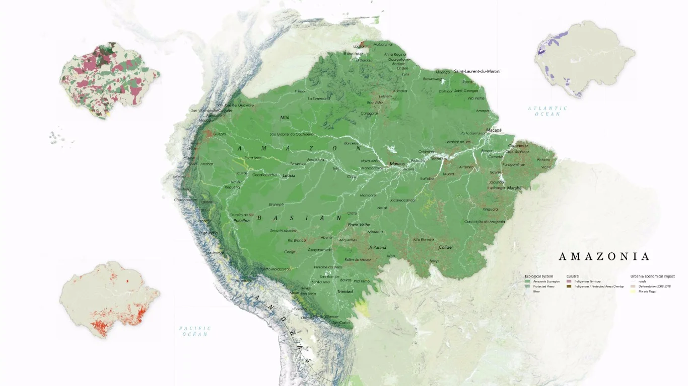
Amazonia
Cartographic replica for the amazing national geographic Amazonia human impact map by ginny mason
FarcloserTravel
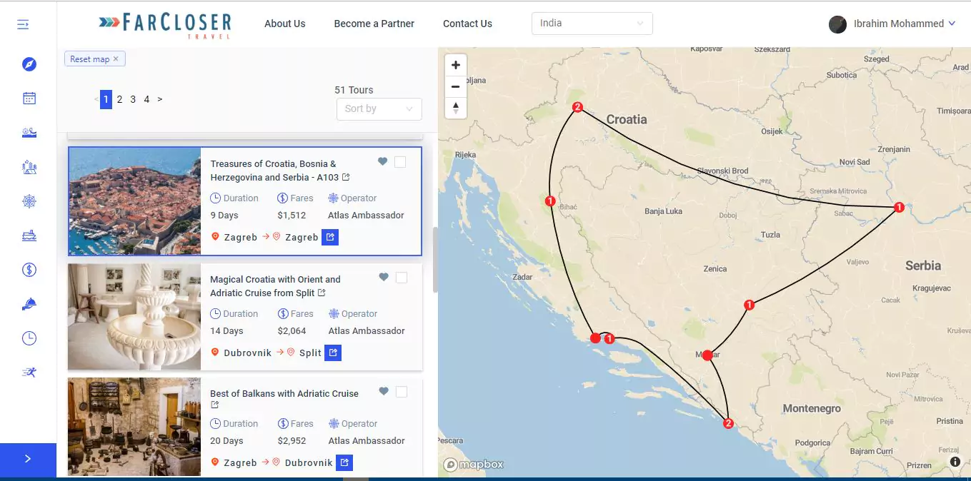
FarcloserTravel
Interactive based web mapping application for multiday tours comparision farcloser travel is a plaɡorm for both travelers and operators with full booking and payment system integration.